NOCAT Route 4 (pdf) Garmin Map
All routes begin at the Vernon Recreation Centre, 3310 37th Avenue, Vernon BC, V1T 2Y5. There are washrooms, a café and plenty of parking depending on scheduled events. The distance calculations for this route begin at the bridge at the main entrance on the east side of the building. Generally speaking, Vernon Avenues (Av.) go East/West (E/W) and Streets (St.) go North/South (N/S).
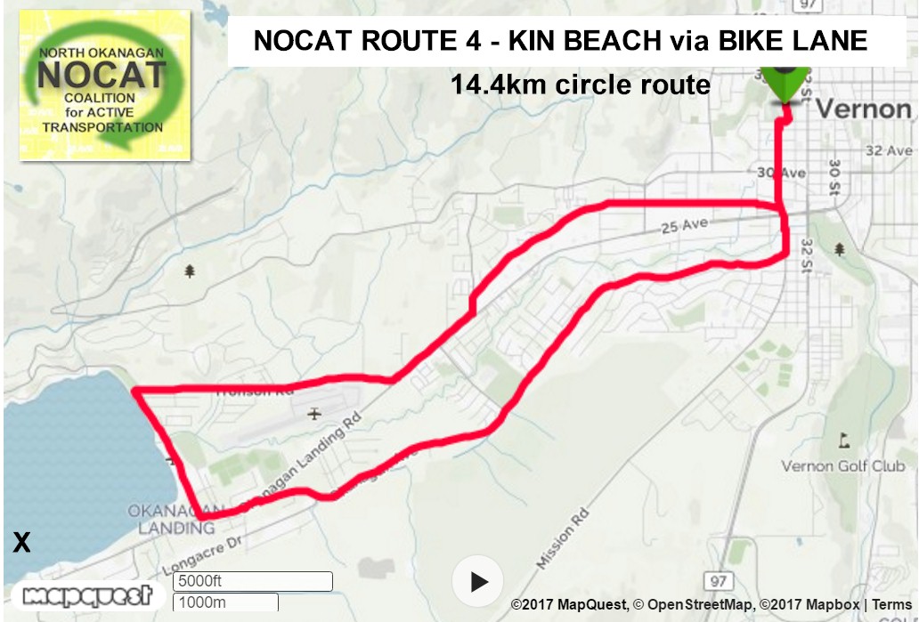
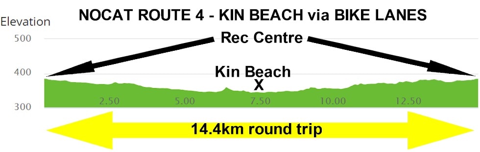
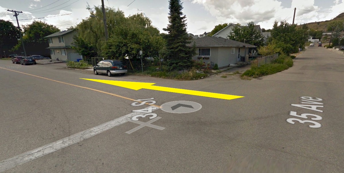
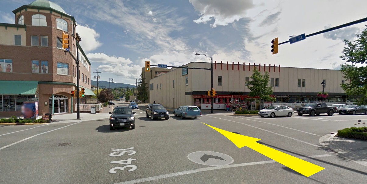
Route Description: Longer on road bike lane route
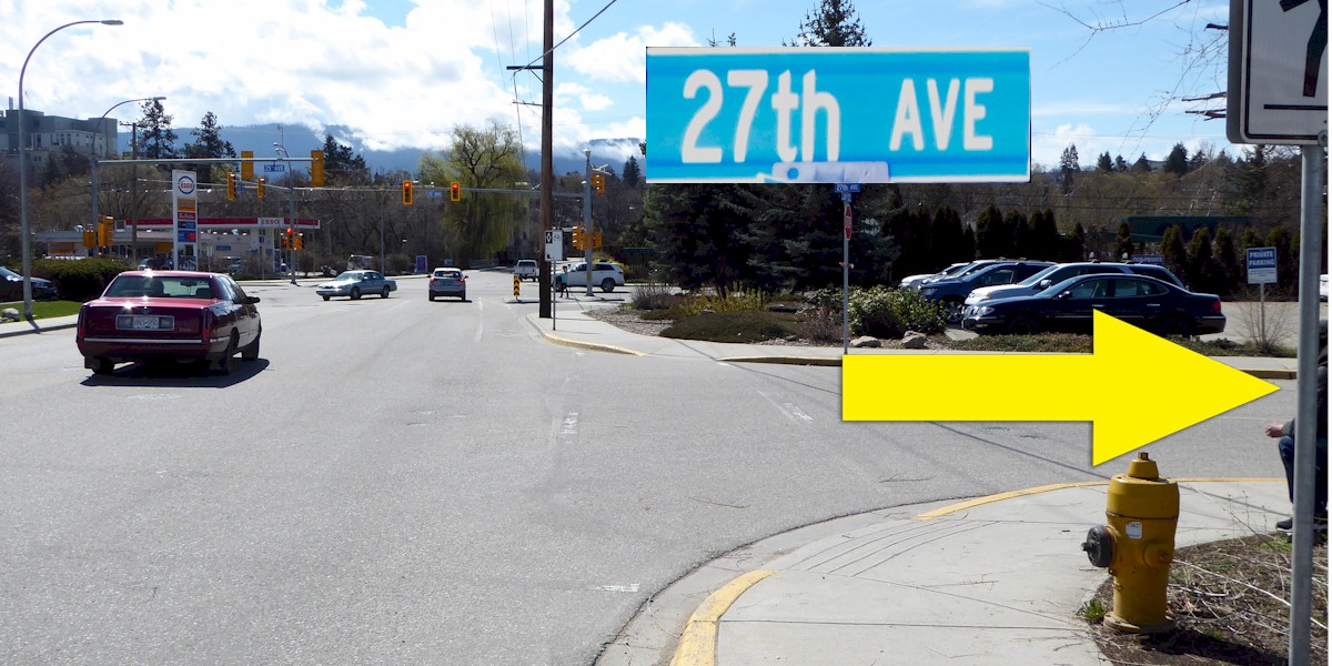
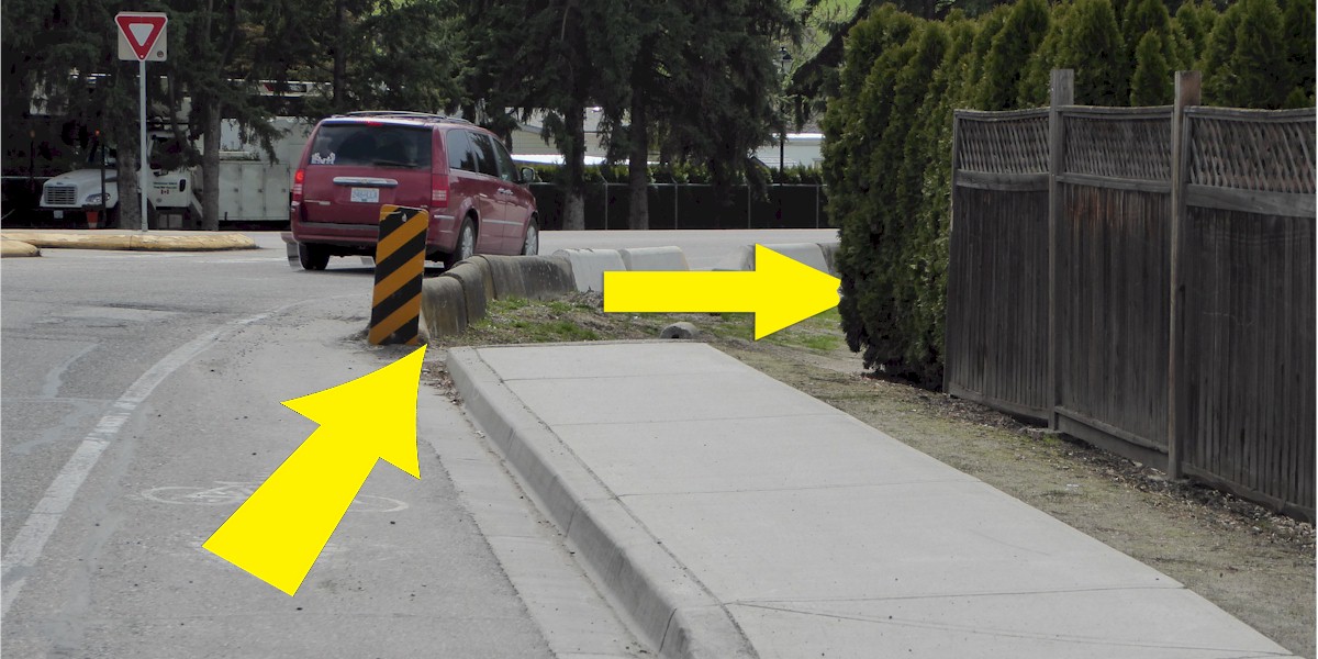
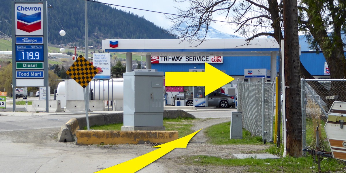
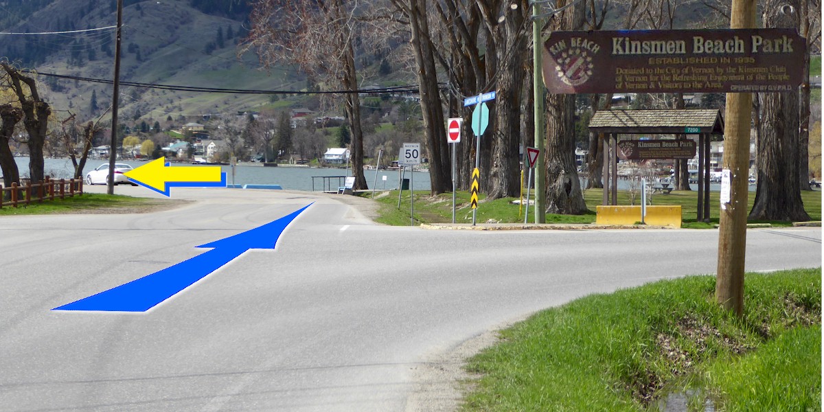
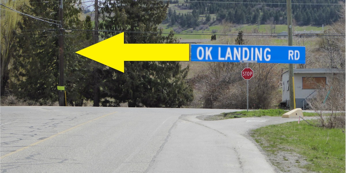
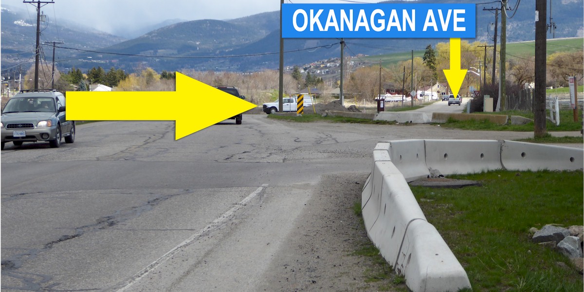
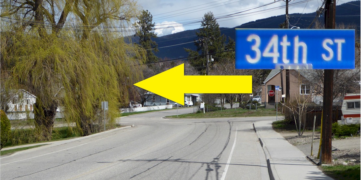
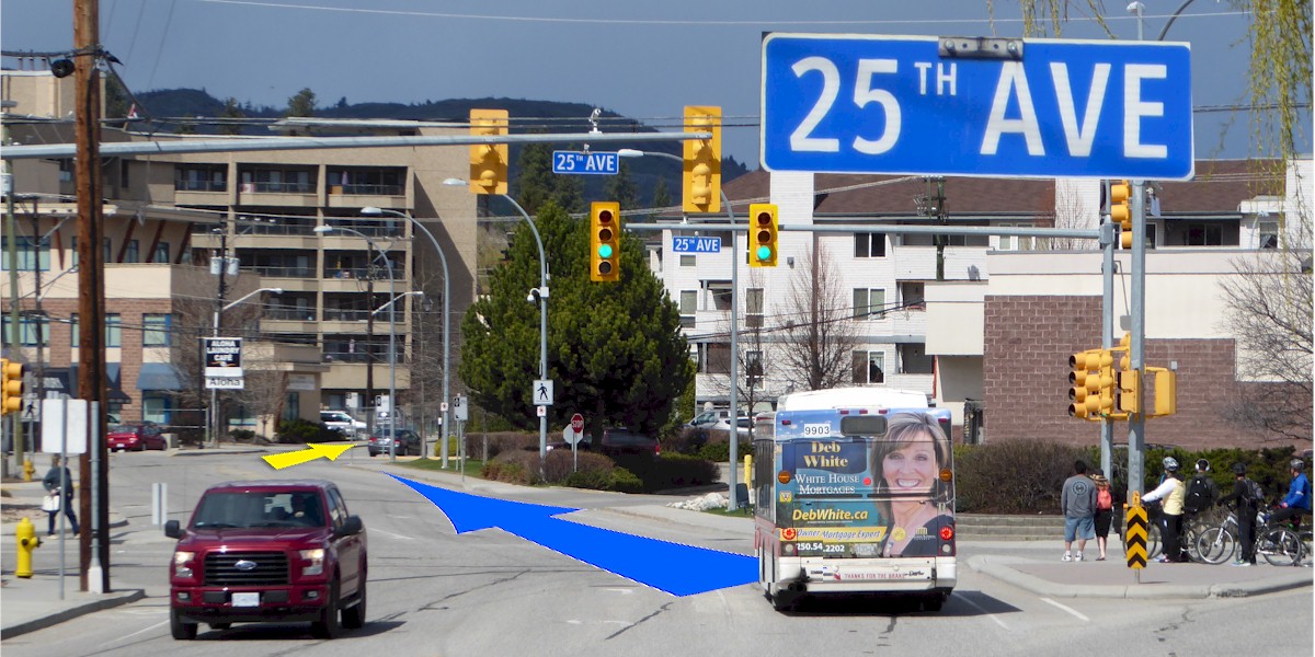
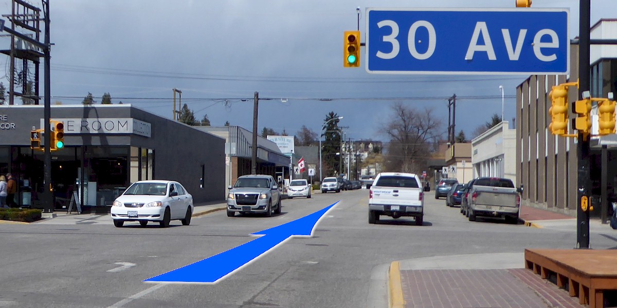
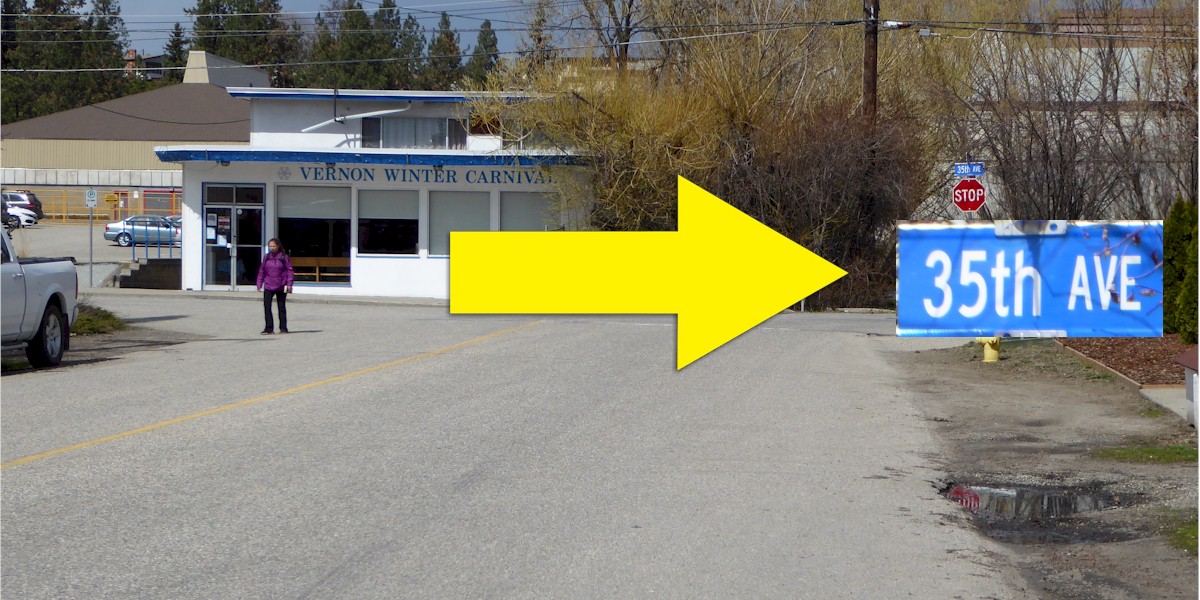
Riders will go from the rec centre South along 34th St to 27th Av. where they will go west following 27th until the Shell station, get on the frontage road until Tronson, Tronson to Kin Beach on Lakeshore. On the return it will be Lakeshore to Okanagan Landing. East on that road to Okanagan Av and follow that to 34th St to return to the rec centre.
Route Description: Longer on road bike lane route
Riders will go from the rec centre South along 34th St to 27th Av. where they will go west following 27th until the Shell station, get on the frontage road until Tronson, Tronson to Kin Beach on Lakeshore. On the return it will be Lakeshore to Okanagan Landing. East on that road to Okanagan Av and follow that to 34th St to return to the rec centre.
Designed by members of the North Okanagan Coalition for Active Transportation (NOCAT)
Disclaimer: Please take responsibility for your own actions, watch for traffic, be careful.
In case of Emergency Call 911
Disclaimer: Please take responsibility for your own actions, watch for traffic, be careful.
In case of Emergency Call 911