NOCAT Route 1 (route pdf ) Downloadable GARMIN Map
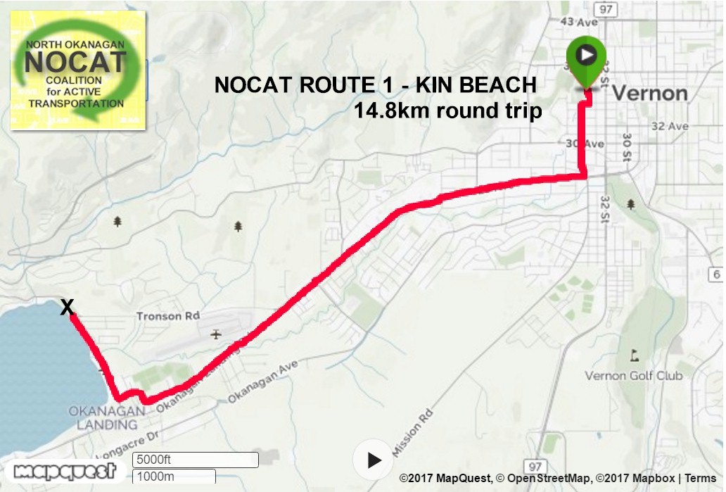
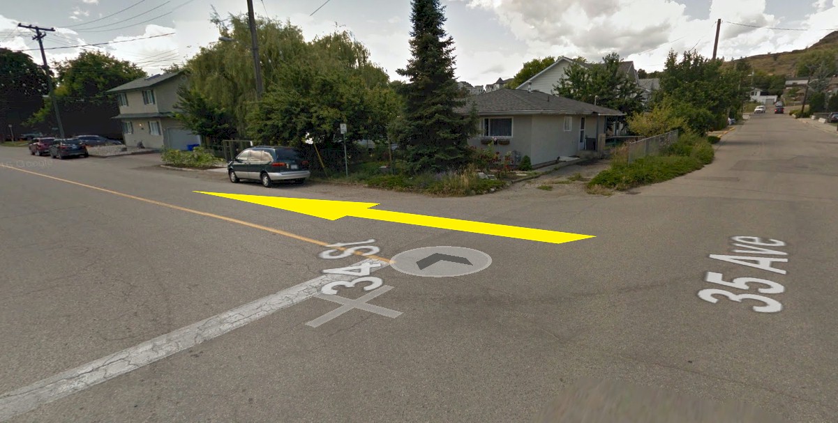
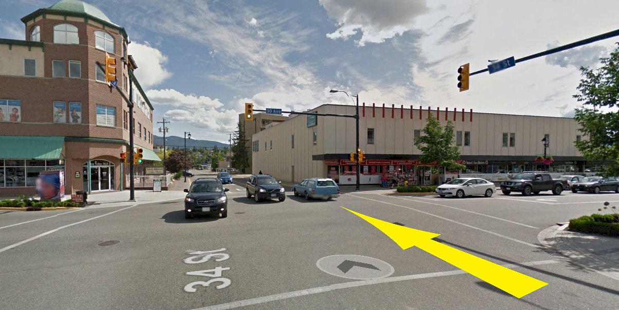
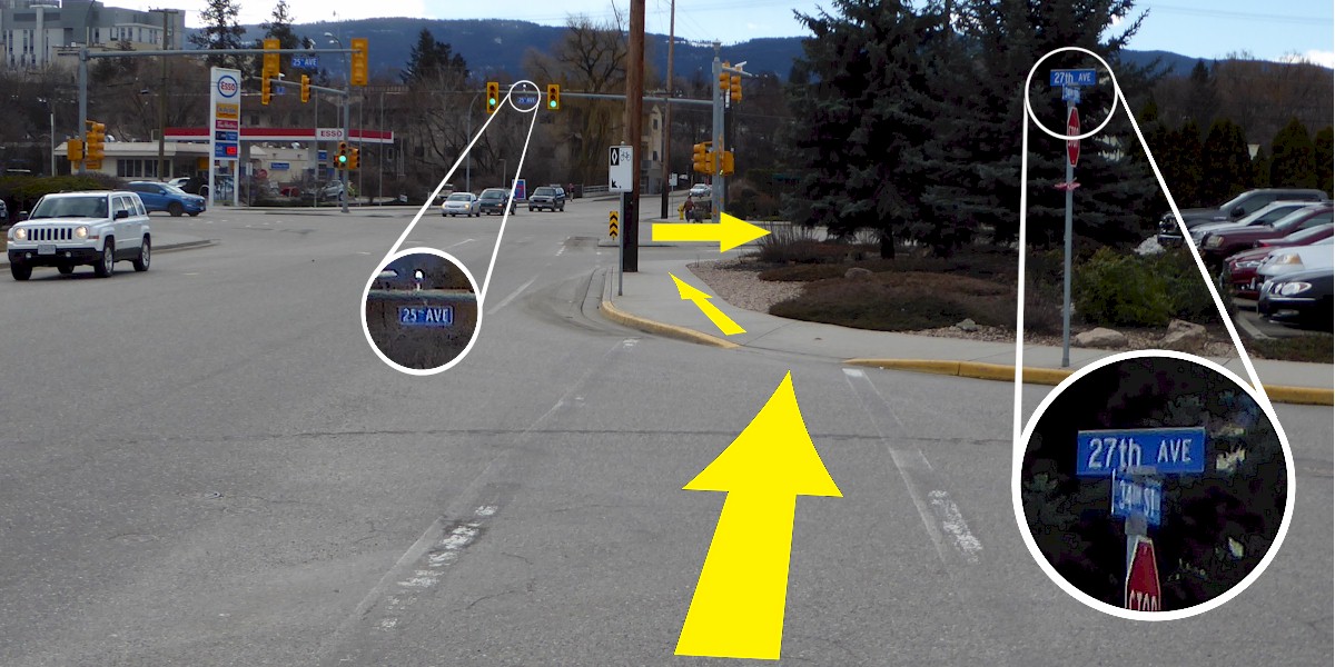
All routes begin at the Vernon Recreation Centre, 3310 37th Avenue, Vernon BC, V1T 2Y5. There are washrooms, a café and plenty of parking depending on scheduled events. The distance calculations for this route begin at the bridge at the main entrance on the east side of the building. Generally speaking, Vernon Avenues (Av.) go East/West (E/W) and Streets (St.) go North/South (N/S).
Route Description: Our most Family Friendly Route
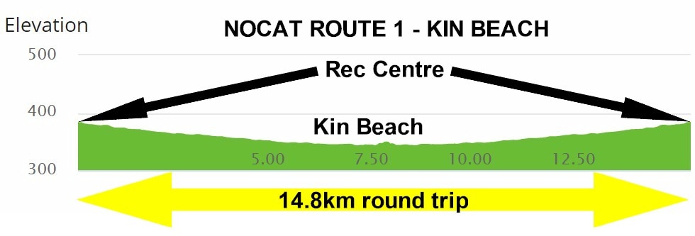
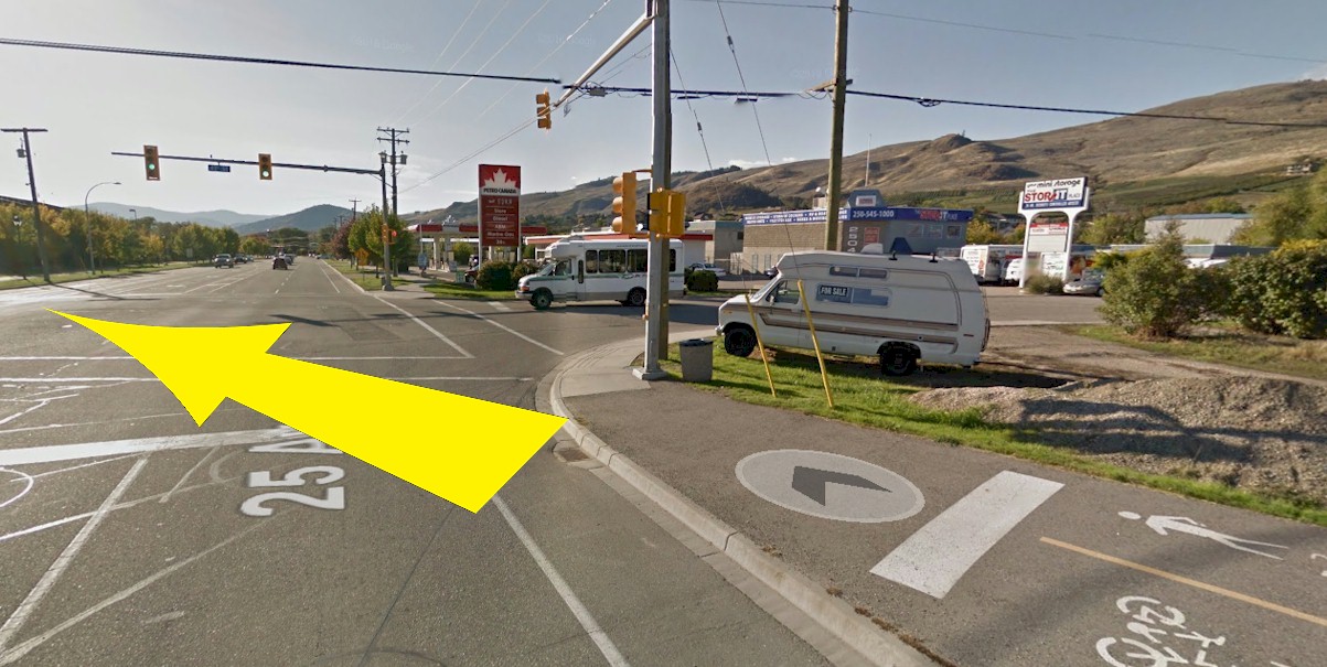
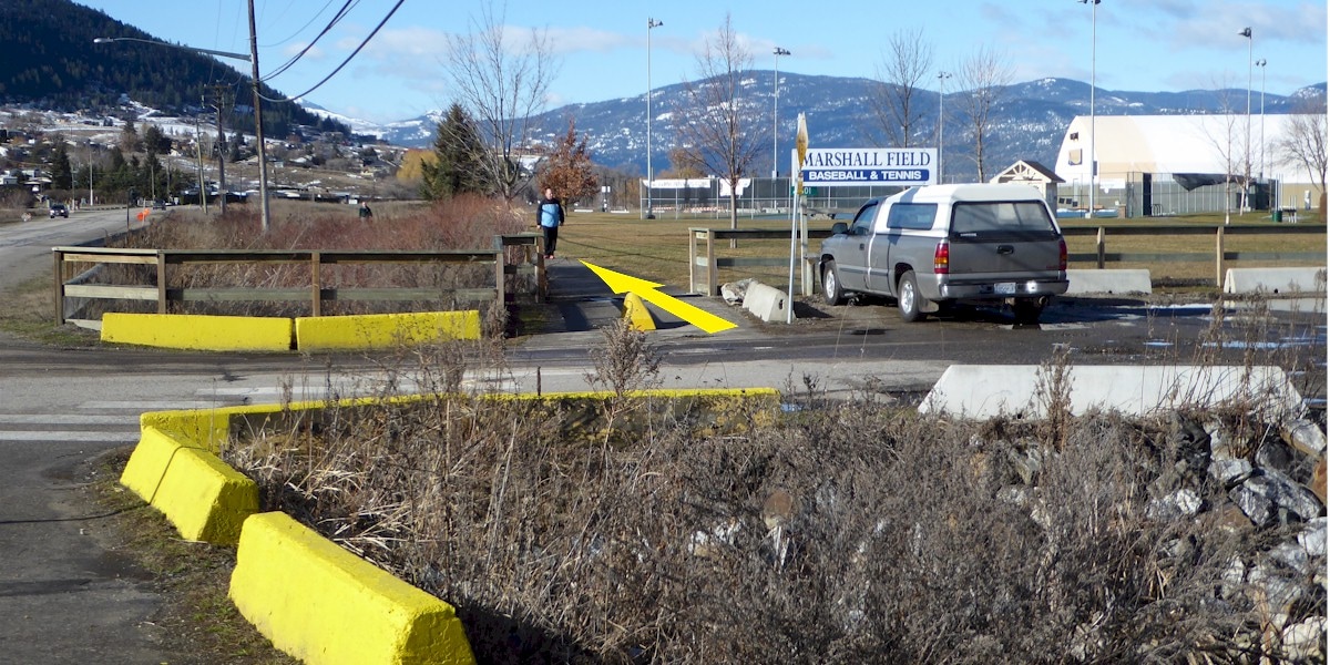
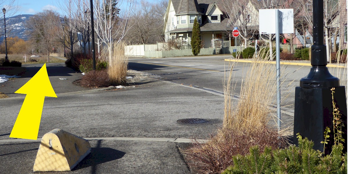
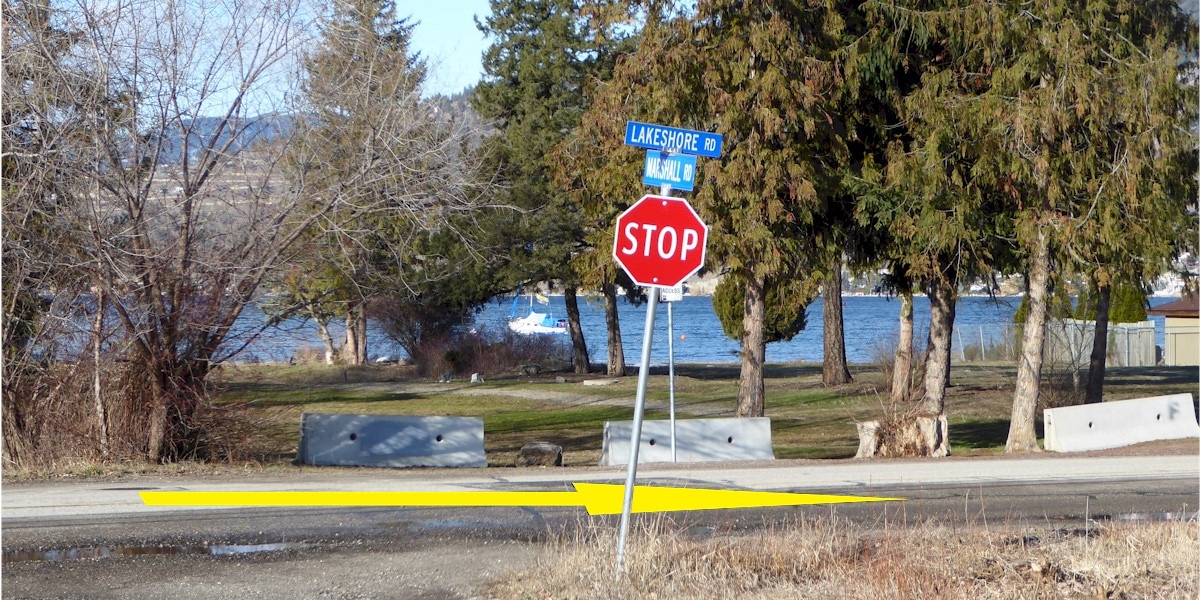
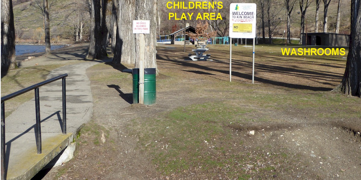
From the Rec Centre you will be travelling south to get onto the 25th Avenue multi-use trail. From there you will ride west to Kin Beach on Okanagan Lake. You will find a beach, playground, washrooms. Food vendors are often present in high season. You may wish to pack a lunch or buy one along the way – please see the route notes for details.
Route Description: Our most Family Friendly Route
From the Rec Centre you will be travelling south to get onto the 25th Avenue multi-use trail. From there you will ride west to Kin Beach on Okanagan Lake. You will find a beach, playground, washrooms. Food vendors are often present in high season. You may wish to pack a lunch or buy one along the way – please see the route notes for details.
Designed by members of the North Okanagan Coalition for Active Transportation (NOCAT)
Disclaimer: Please take responsibility for your own actions, watch for traffic, be careful.
In case of Emergency Call 911
Disclaimer: Please take responsibility for your own actions, watch for traffic, be careful.
In case of Emergency Call 911